Profile
Allvision IO is a Pittsburgh-based geospatial intelligence company specializing in automated asset inventories and infrastructure analytics. Founded in 2017, the company leverages a combination of autonomous vehicles, high-frequency mobile mapping, satellite and aerial imagery, GIS platforms, and advanced machine learning/computer vision to create and maintain highly accurate, time-based digital twins of physical infrastructure and environments. Allvision’s platform transforms raw visual and spatial data into rich, interactive, and continuously updated geo-spatial models that deliver actionable insights for transportation, mobility, utilities, and infrastructure management. The company’s tagline, “We Find What Others Can’t,” highlights its ability to detect and analyze critical assets that traditional methods often miss.
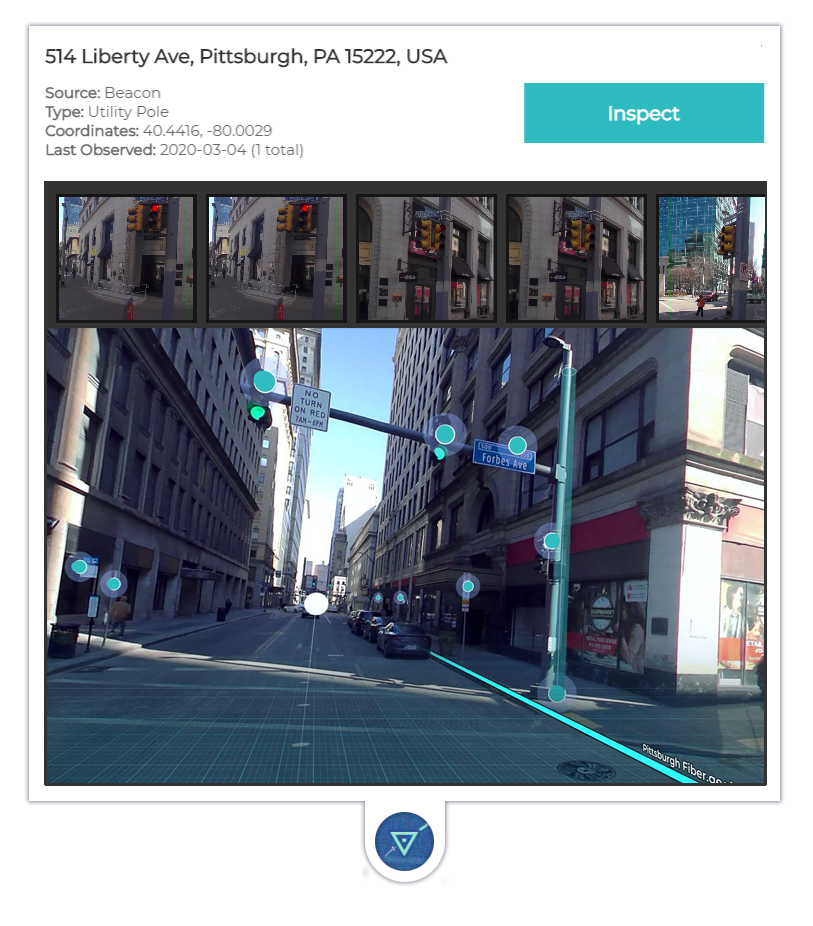
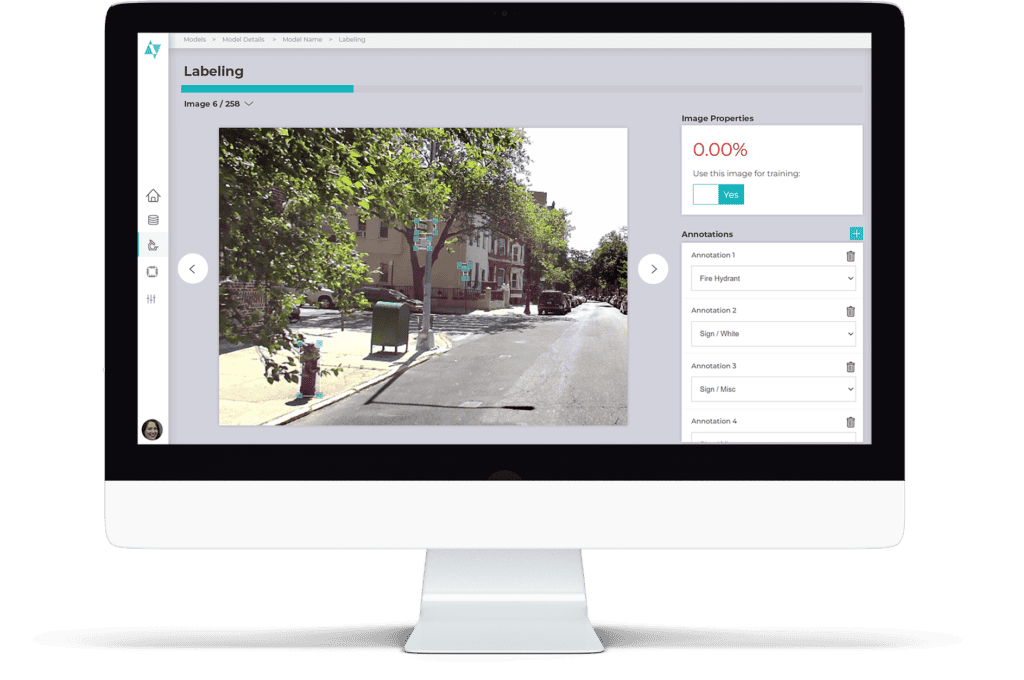
Allvision does not manufacture physical robots. Instead, it partners with fleets of autonomous and mapping vehicles equipped with advanced sensors (LiDAR, panoramic cameras, etc.) to collect high-definition street-level data. This data is then processed through its AI-driven enrichment platform, which uses computer vision and machine learning to locate, classify, and analyze infrastructure assets such as traffic signs, road markings, utility poles, vegetation encroachment, parking spaces, and more. The resulting intelligence is delivered through cloud-based web tools, APIs, and interactive 3D models, enabling customers to monitor changes over time and make data-driven decisions.
Core Capabilities and “Robot-Based” Data Solutions:
- High-Frequency Data Collection: Leverages autonomous vehicle fleets and mapping partners for regular, up-to-date captures.
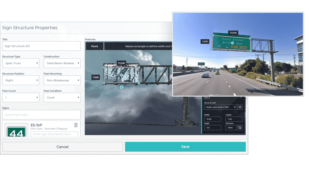
- AI Enrichment: Automated detection and classification of thousands of asset types with high precision using panoramic imagery and dense 3D point clouds.
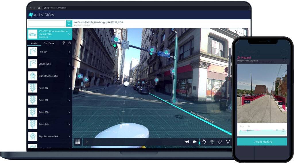
- Interactive Analytics: Cloud-based portal (Beacon) for inspection, measurement, monitoring, and reporting on infrastructure conditions.
- Applications: Vehicle turnover optimization in commercial zones, vegetation management for utilities, asset inventory maintenance, and urban planning insights.
Allvision’s solutions are particularly valuable for cities, transportation agencies, utility companies, and private infrastructure operators seeking cost-effective, scalable ways to maintain accurate digital records of physical assets. By combining mobile robotics data collection with powerful AI, the company delivers a practical, continuously refreshed view of the built environment. It continues to expand its coverage and AI capabilities, helping organizations move from static maps to dynamic, intelligent infrastructure intelligence.
Map
Sorry, no records were found. Please adjust your search criteria and try again.
Sorry, unable to load the Maps API.